Forty Years and Counting
“Tomorrow’s the day.” The voice on the phone was recognizable, but expecting identification before message, I was taken aback by the abruptness of it all. Not, “Hello, this is ____________, how you doin?” or any such common informality, just, “Tomorrow’s the day.”
At that moment I was engaged in making up a towrope, knowing that at the field from which I hoped to fly the next day they would likely not be so equipped. Also, I knew they would not have a tow hitch for their Cessna, which would be necessary for the towrope to do its thing. The towrope was a comparatively simple undertaking; the hitch, was another.
It was Thursday, April 1, and since I had Thursday and Friday off, thought I had time to craft the needed tow release, and with the necessary metal raw materials, headed for Dave Blanton’s shop where I hoped to shape the required parts, assemble them into a usable release, and be on my way. Of course Dave wondered what I was up to, after all it was his shop, and so I explained my plan. He didn’t think much of my plan, said it would probably take me too long and that I would likely not have a device to be proud of when I was through. He then unlocked the cage in which he kept valuables such as instruments, dug around in it for a while, came out and presented me with a professionally made, complete with cad plating and inspector’s stamp, genuine tow release. Price, $8.00. That was many years ago. Now you can get one for about twenty or so times that.
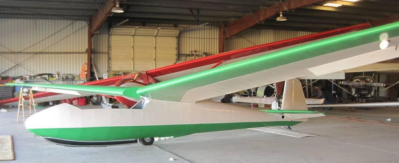
Ten years earlier I had purchased a set of BG-12 plans from the venerable Gus Briegleb, who had designed several gliders and finally one with some performance, and set about building. Bob Nichols, a Boeing engineer, was keen to draw up a high performance wing in wood, and so the ship became the BGN, with a fifty six foot span and an aspect ratio of nearly twenty-five. Two children, a college degree, two changes of address, and six years later, the ship took to the air. It had given me several good flights in the previous few years, and, by the time Mr. Blanton supplied the tow release, cause to believe greater things were possible.
I then went to David’s, which was one of the earlier discount stores, on the far east side, and purchased 150 feet of ¼ inch polyethylene rope. I had earlier acquired the rings and thimbles for the rope ends. Also, I had that afternoon checked the weather and was convinced that the next day would be calm, with good lift, and that it would very likely be a great day for a triangular flight, maybe even for a record.
Then came the phone call. Ring, ring. “Hello.” “Tomorrow’s the day.” “Tomorrow’s the day for what?” “Tomorrow’s the day for a flight to the gulf.” “But my information is that it’ll be calm tomorrow and I was thinking of a triangle.” “Oh no, the winds aloft tomorrow will be from the north at up to fifty knots aloft and you’ll be able to overfly Dallas.” It was the voice of Jim LeSueur, Cessna test pilot and Air Force jet jockey. To say that he knew weather better than I would be to understate things, though, as it turned out, we were both wrong. Anyway, before the call ended, Jim said he’d come get me after work the next day if that was necessary, and so I explained that I would try to get a tow from the Newton airport and my car and trailer would be parked there. I considered it all to be high powered encouragement and so quickly finished the rope, smoked and wound the barograph, and laid out some cold weather clothing. The high for the day was projected to be 60, and Jim said I would probably be able to get pretty high, so cold weather stuff was called for. Among other things, I set out combat boots and socks, fur collared coat, and a Russian style fur cap complete with fur ear flaps and under chin string. The boots were a big mistake as there is nothing colder than a cold boot and I suffered numb toes from about the second hour on. However, I had nothing better available. It would have been no joy to have made a great flight and suffered the loss of toes.
Excitement. Exciting enough to delay the onset of sleep, but I did wake up in time to get to Newton early and begin assembly. The north wind Jim had predicted was northwest and strong at the surface and the FBO was nice enough to let me assemble partially in their hangar and partially out, but out of the wind. They even held the tips while I ran the pins home. I taped up, got out the release and rope, and went to explain what was needed of them for a tow.
To equip the average Cessna for towing is simple. The tail tie down ring is backed out, the release positioned over the screw hole, the tie down screwed back in, and an exterior line run from the release to the cockpit and secured to the door post. I had done it many times on various Cessnas. The FBO was new, and run by a pair of partners. They weren’t taking any risks, particularly not for the benefit of some glider pilot they’d never seen before. One of them got on the phone and called the Cessna plant. Was I hearing correctly? Was he asking whether the simple installation of this device required the expertise of a licensed mechanic? That’s exactly what he was asking, and the response was that was exactly what was required. “Well, aren’t you an A&P?” “No.” An FBO without an A&P? Well, they didn’t stay in business very long, either.
What to do now? Would they turn their backs while their Cessna suddenly grew a tow release on its tail? No. Things looked bleak. I was unaware of such a requirement or I wouldn’t have chosen Newton airport as a start point. Frustration at the max. The day wasn’t getting any earlier and every minute lost, it turned out, was a mile shorter flight, if I could get into the air at all.
Were you ever involved in one of those occurrences that approach the miraculous, an inexplicable solution to a worrisome situation, the timing of which cannot be explained by mere coincidence? It happened. A small plane approached the area. I watched it enter the pattern and land. Maybe the pilot could pass on some information regarding turbulence or other indications of possible thermal activity. It was a Cessna 140 and it rolled up toward us. Maybe he had seen the glider from the air and was curious. Well, if I couldn’t fly, maybe I could spread the good word about soaring to another power pilot. He rolled closer. Did I see what I thought I saw? Yes! The little Cessna had a tow release mounted above its tail wheel!
I reached the pilot’s side door and saw that it was John Meredith, a member of our glider club, and yes, he would provide a tow. The 140 is not considered to be one of the world’s greatest towplanes, but you can bet I thought at that moment that it was, and of course, it was the best available.
Park the car and trailer out of peoples’ way, fill the water bottle, turn on the barograph, push out to the runway, lay out the rope, discuss the tow with John, stow the lunch and the maps, secure the barograph behind the seat where it can’t be reached during flight, hook up the rope, check the release, rehook the rope, get in, belt in, close and secure the canopy, signal the tow pilot, and start the takeoff roll.
Good climb during the tow, indicating good thermal activity. I noticed, way off to the northwest, a fairly large cloud of dark smoke. No idea what it was from, but while it looked to be rising fast, it topped out flatly at a level that didn’t look all that high. Well, maybe this will be a first tow and we’ll have to wait for conditions to improve. Off at 2000 feet a mile and a half northwest of the runway, ten thirty on the nose. Blundered almost immediately into a four knot thermal, which wasn’t bad for mid morning. That would be the best lift I’d see until Missouri. The lift topped out about 8,000, and when I looked to the northwest at the aforementioned smoke cloud, its flatted top was still above me. This could turn into a good day.
The polar Canadian air mass is generally sparklingly clear and objects all the way to the horizon look sharp and closer than expected. While still in that first climb I noticed what I thought were a couple of hawks off to the northeast. It would be unusual for hawks to be that far above ground, as there’s not much for them to eat there, but I have seen them that high. As I climbed above them and they got closer, I saw that they were not birds, but high-winged military cargo planes, probably from the base at Topeka. At first I thought they saw me and banked away to avoid sharing the air space too cozily, but later felt that probably they didn’t but were using the Newton airport as a turn point. The air was clear enough that while still far away they appeared as cruising birds.
What was learned in that first thermal was that the wind was fairly strong, though probably not in the 50 knot range as Jim had predicted, and was definitely not from straight north. In fact it was almost westerly. I tried at first to maintain a ground track to the south as my maps covered such a course. The second thermal was weak and the drift was strongly to the east. When I topped out over the Augusta refinery I said to heck with this, I’ll go with the wind, not fight it. That’s fine, but I had no maps going east, and over the town of Moline, ran off what charts I had. Goodbye navigation aids, hello pure adventure.
The wind seemed to pick up and I began to notice a lot of blowing dust on the surface, and it was blowing straight down the east-west country roads. The thermals remained weak, in the two and a half to three knot range, and rough. Although I had two quarts of water with me, the flight was too bumpy to drink it. It was in a mason jar that was coated with three quarter inch Styrofoam insulation. Its cap had to be unscrewed to drink from it, and with the rough air the glass rim was hitting my teeth hard enough when I tried to drink that I was afraid of cracking a tooth. I ended the flight with the bottle mostly full.
No clouds to cap the thermals and show the way to the lift, which remained weak. I’m not too familiar with the geography of eastern Kansas, so didn’t know which of the towns below was which, but if you drew a straight line east from Moline to the Missouri border, it probably would be close to the ground track. Somewhere in eastern Kansas I began to see cumulus up ahead and gradually overtook them. Finally some markers! Flying efficiency should increase at least some. They didn’t help much as by the time I’d reach one, its lift would die, and out in the blue space between clouds I’d find lift. Still weak lift. No maps to check how far I’d gone in a certain time, so didn’t know what my ground speed was. Pretty soon I saw a fairly large urban area ahead and concluded it had to be Joplin.
I’d heard that the Feds had made a large marijuana bust recently in Joplin. Way up to the northeast I saw a large column of whitish smoke and the thought occurred that maybe they were getting rid of the stuff. Well, it wasn’t very far out of the way, and I didn’t know where the flight would take me, so I diverted to the smoke column. I can’t say that I’ve ever smelled marijuana, so couldn’t identify it anyway, but when I got to the smoke, it smelled like burning wood. Good thing I went to it as it resulted in the strongest and highest climb of the flight, six knots to nearly 10,000 feet. That was the kind of high I was after.
Now the flight began to approach serious adventure. From here on—Ozarks. Ozarks are fine, but don’t appear too inviting to gliders. Hills and forest almost everywhere. The cross-country glider pilot must constantly check the surface for landing spots, and I wasn’t seeing any. Even what cultivated fields there were looked small and hilly. Then the big “duh” began to settle on me. Here I am, averaging a mile to a mile and a half above the surface with a glide ratio over thirty and a strong wind boosting that ratio to over fifty—I can’t even see the point at which I’d contact the ground even if there was no more lift, so I put the worry out of mind.
The lift continued in the two and a half to three knot range and rough both in and between thermals, which meant a lot higher percent of time circling. I’d crank around and around, and one of the things I’d see was a large lake to the south. I’d crank around some more, top out, glide some, circle some more, and still, couldn’t seem to leave that lake behind. Wait a minute—there’s a strong west wind, I’m gliding some to the east, why can’t I get away from it? Well, a cursory look at a map of the area to the south shows a series of lakes sort of paralleling my flight path. Concentration on finding and keeping lift (and possibly effects of altitude?) kept me from realizing that it couldn’t have been the same one all the while.
More Ozarks and more forest. My flight path gradually turned more southeasterly and over what I later learned was Lake Norfolk, I crossed into Arkansas.
About this time there began to appear up ahead a large area of smoke. There’s not that much marijuana in the world. Forest fire? Yes, indeed. Would it provide better lift? A little, and I passed the area quickly.
Always looking way ahead, trying to discern possibilities, the eyes strain for any usable intelligence. The Canadian polar air, while sparklingly clear, does have its modicum of murk, and the canopy glass is never completely clear of pollution and fine scratches. The funny thing is that the subconscious somehow saw through those and the distance. Goose bumps! The hackles raised! The pulse quickened! What was going on? It couldn’t have been effects of altitude as I never topped 10,000. Was the cold getting to me? The feet were numb, but I’d never known cold feet to raise goose flesh. The skies weren’t opening, Gabriel’s trumpet wasn’t sounding, nothing supernatural to account for it, what was it? I leaned forward as much as the canopy would allow as if getting a wee bit closer would bring an answer.
Somehow, with all the drama, “duh” doesn’t fit. “Eureka” better fills the bill. Here it was, the middle of the afternoon, and it began to dawn on me. Up ahead was a break in the topography—the Ozarks were ending and the flatlands of cultivated fields, square sections, straight roads and landable areas were beginning.
How that message was received by the subconscious before conscious realization is beyond me, but it happened, and it brought new waves of excitement.
Where would the flight end? How close was I to the Mississippi? Have I already, or would I soon exceed diamond distance? Although I had crossed into Arkansas, I had no maps to tell me that. I had an uncle living in Poplar Bluff, Missouri, and wouldn’t it be neat to drop in on him? Was that even a possibility? Hang on, Bernie! If I get to the Mississippi, would I have enough to cross it? Across the Mississippi is some state such as Tennessee, or Kentucky, or whatever, and although the river is but a mile across, to land in one of those states sounds miles and miles farther than landing short of it. I’ll keep my eye out for a large, blue, snaking surface feature.
Meanwhile I see an airport and on top of a hangar it says Walnut Ridge. How can I read that from up here? Ooh, I’m getting lower. Two more towns, it doesn’t seem possible to have identified them both, were Paragould and Jonesboro. I had no idea how close either was to anything, but I kept looking for that big blue snake.
A large snaking feature began to emerge from the distance, but it was anything but blue. In fact it was gray. Was I expecting blue because that’s the way large rivers are depicted on maps? This was gray and large, and had to be the Mighty Mississippi! And I had enough altitude to cross it. Oh, glory, what a story! As I approached it, it looked less and less like anything I knew to be a river. It turned out to be what is called the St. Francis River, and crossing it on the surface during the return the next day, it was a river-like swamp filled with very tall cypress trees, which hadn’t yet leafed out, thus the gray. Much disappointment.
By now I was becoming obsessed with Mississippi, and as the flight was in its final glide, doubt as to seeing its waters was building. Not very far past the swamp, though, a large, snaking, and very blue river began to fill the horizon, and I was high enough to get there. Hackles again. If the barograph had done its thing, diamond distance had to have been overflown and the diamond badge was complete.
Now, how to finish the flight. A fair-sized town appeared ahead, and should have an airport. I didn’t see one. I could see across the river and saw nothing to suggest a safe landing spot—extensive forest, and no cultivated fields. I’m now down to 1,200 and can barely make it across town and then the river. I pick a cultivated field, which looked to be within city limits, turned into the wind, and put her down. The field was planted, I think cotton, with the seedlings in furrows about a foot or more deep. The BGN fuselage is a rounded v-shape. I touched down on the crest of one of the furrow sides, slid quickly to the bottom of the furrow, the sides of which grasped the fuselage and decelerated it rapidly enough that I thought I heard it groan.
A wing went down, I removed the canopy and looked about, and the first thing upon which my eyes came to rest was a wind sock not 100 yards distant. I could have landed on a duster strip. However, it was north-south, and the wind was still westerly. I sat for a while. After all, my feet had been numb for hours and I doubted they’d hold me. Finally, out of the ship, I saw why the lift had ended. There was a crust of dried dirt over wet ground. It had rained the night before and the day’s sunshine had gone for evaporation instead of making thermals.
No idea what town I was in, or what state for that matter, so, when my feet would hold me, I began the walk out of the field. It was here than when I had left Newton, and I must have been a sight, looking like some wannabe arctic traveler who went south instead of north and didn’t quite make it to the landing strip. It was a short walk to the road and as I approached the edge of the field a siren began to wail. It came closer. Of course! With one wing down the ship looked like some unfortunate had crashed, someone had reported it, and the law was dealing with it. The deputy approached, sprayed gravel as he turned the corner and again as he slid to a stop, never gave me a second look, and hurried out to the “wreck.” Finding no victims there, he returned to his vehicle, saw me, got the word from my viewpoint, and gave me a ride to headquarters. On the way, I noticed that the auto license plates said Arkansas, so I knew the town wasn’t Poplar Bluff, which isn’t on the Mississippi anyway. On a wall map at the station, one of those with a string leading to a tack in the center, I saw that the town I was in was Osceola, Arkansas. I asked to use the phone, gave the necessary info to my good wife who would then relay it to Jim LeSueur. The landing time was 5:30 for a flight of exactly 7 hours, a little over 62 mph. With a wind of around 30, you can see that I only contributed a bit over 30 mph. Jim was still at work when the good wife called. All he had to do was drive to Newton, make sure my rig was roadworthy, drive all night to Osceola, help trailer the ship, and put up with my jubilance on the ride back. He inveigled our mutual friend, Paul Wilson, to accompany him.
The deputy took me to the nearest motel, I had a catfish supper, watched a pro basketball game on TV, had a good night’s rest, up early as Jim and Paul arrived, loaded the ship, breakfasted, and began the return. Jim and Paul dozed a lot on the way back.
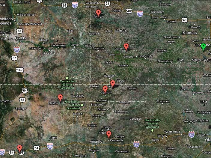
Jim later used what at that time served as a computer (IBM mainframe complete with punch cards) to figure the distance. Given the latitude and longitude of the start and end points, it worked out to 436.0585 miles, figuring to within less than half a foot. Good for the state of Kansas distance record, which has stood now for forty years.
Arrived home well after dark, and there waiting was Dave Blanton with a magnum of champagne. Never a more enjoyed tribute. He said it was a great flight. I drank to that.